
At the April 1st, 2021 BPAC Infrastructure Committee meeting, Charlie Ream and Colin Piethe gave a presentation on the High Street Paving Project.
The presentation [PDF] and notes from the presentation and discussion are below.
Project Description
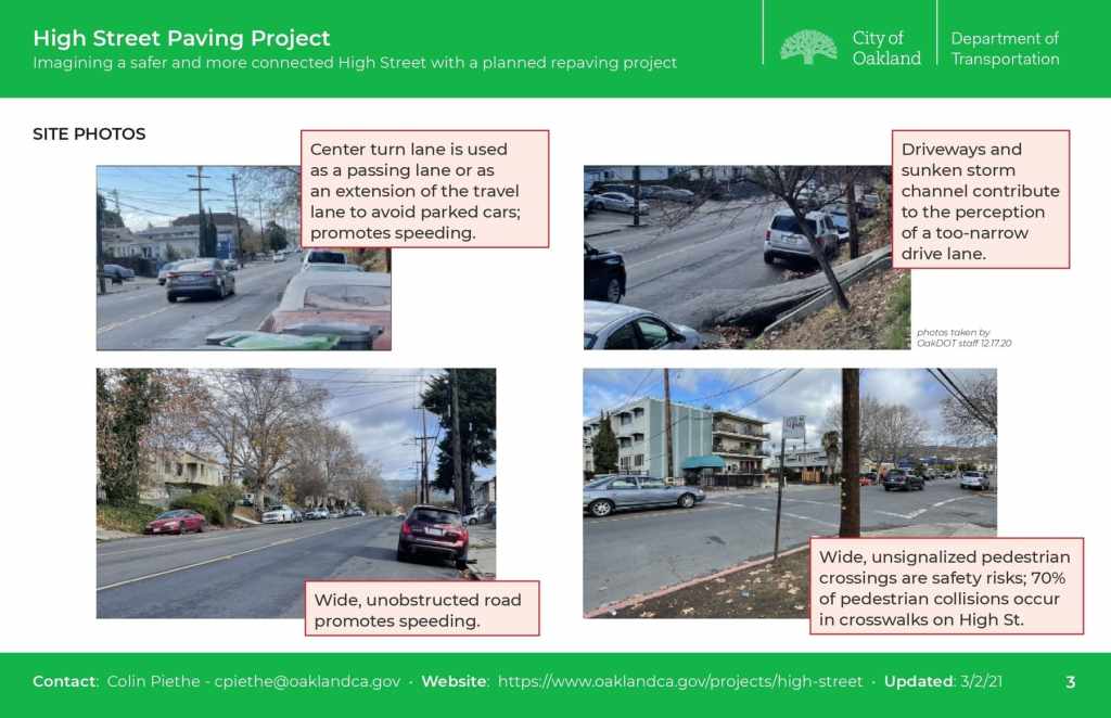
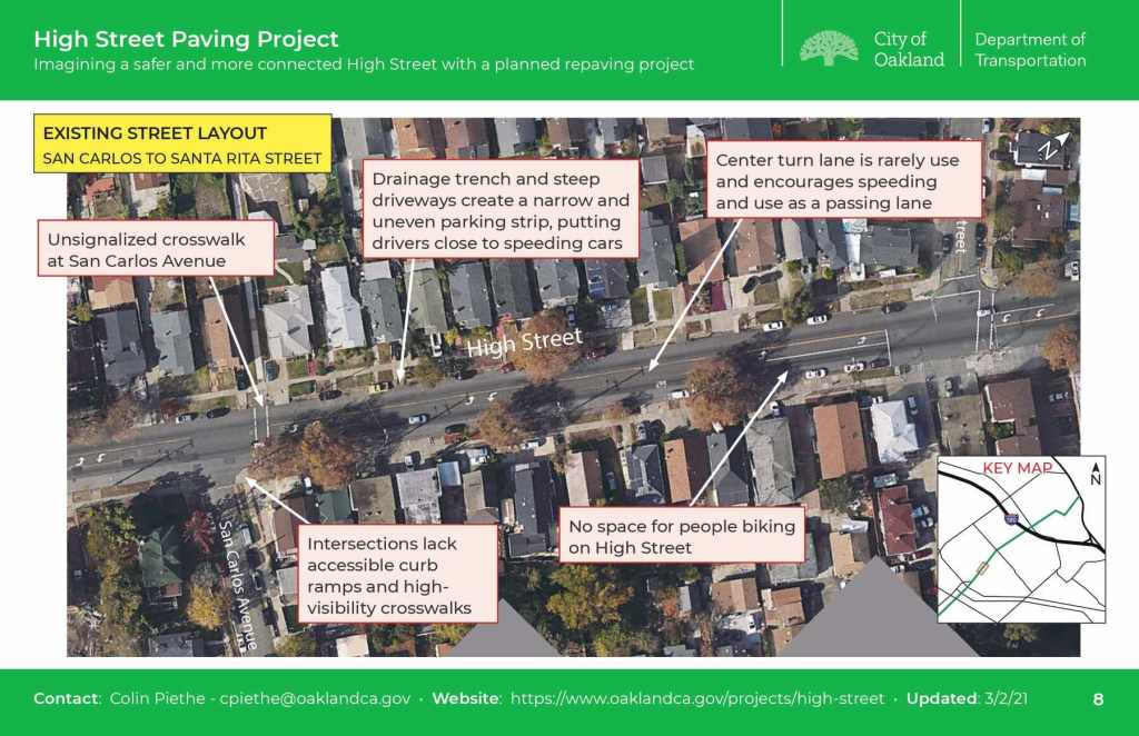
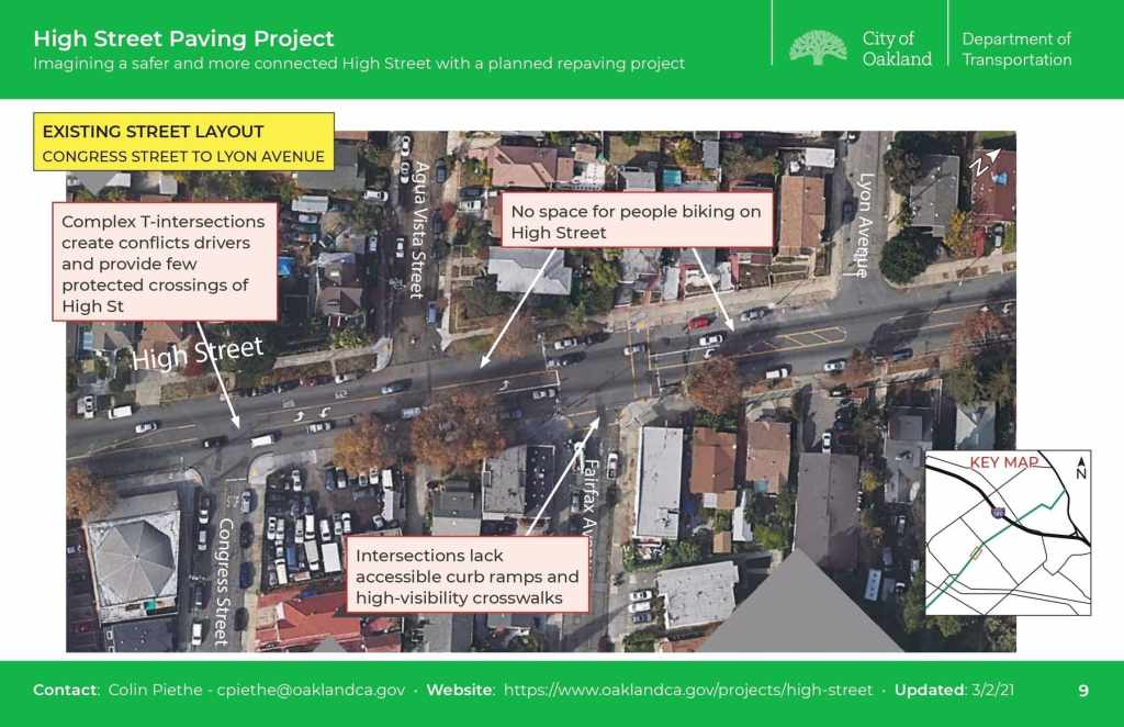
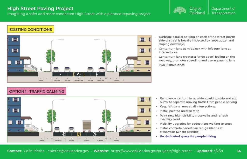
High Street is an important east-west corridor that connects the Laurel District, Maxwell Park and Allendale to International and Foothill Boulevards. High Street is primarily residential in character with a vibrant mix of businesses, parks, schools, and churches. For most of the stretch between Foothill and I-580, High Street has two travel lanes and a center turn lane. This center turn lane is rarely used for turning vehicles and is commonly used as a passing lane, encouraging speeding and unsafe driving. There were two fatal collisions on High Street in the last 10 years, and 225 collisions in the last 5 years.
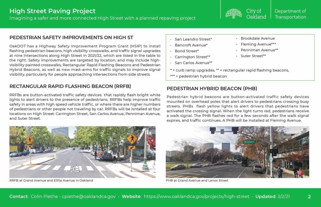
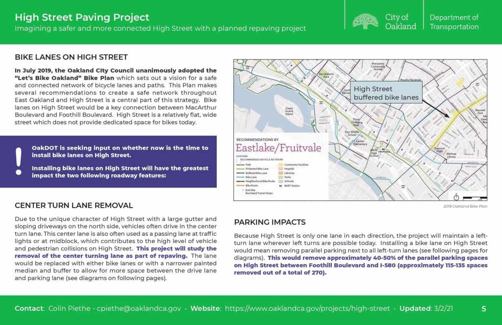
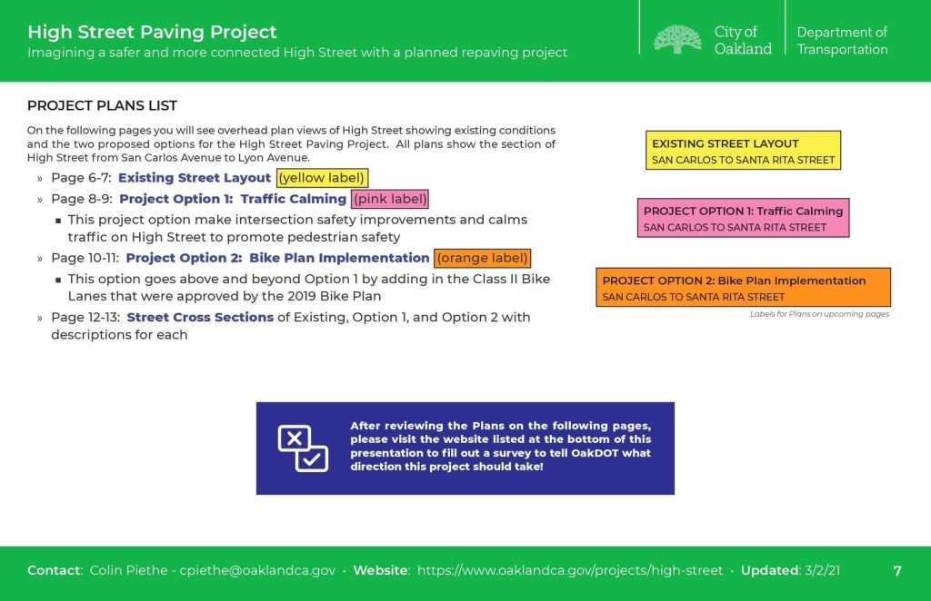
OakDOT has a Highway Safety Improvement Program Grant (HSIP) to install flashing pedestrian beacons and traffic signal upgrades at nine intersections along High Street in 2021/22 (shown as white dots on map at right). OakDOT will also repave High Street between Foothill Blvd and Tompkins Ave in 2021. The 2019 “Let’s Bike Oakland!” Bike Plan calls for bike lanes on High Street, which would close a gap in East Oakland’s bicycle network.
Repaving offers a rare opportunity to reimagine this roadway to better respond to the needs of people walking, biking, and taking transit while maintaining the same access and space for people driving. In order to coordinate potential safety improvements with this paving project, OakDOT is conducting outreach to neighborhood residents and stakeholders to asses their needs and priorities.
Project Goals
- Slow vehicle speeds and curb unsafe driving
- Reduce vehicle collisions
- Improve safety and comfort for people walking, especially crossing at major intersections
- Increase the visibility of people walking and biking
- Investigate providing a bicycle lane for people biking on High Street
Project Schedule
- Feb/March/April 2021 – Public Outreach
- Online Presentation and Online Survey to get neighborhood feedback
- Presentations to stakeholder groups (email OakDOT staff if you’d like to set up a small-group video chat)
- Postcard mailer to the High Street community
- Social media/online outreach
- Spring 2021 – Select final design for street and post online/email to survey respondents
- Summer 2021 – Roadway design
- Late 2021/early 2022 – Roadway repaving
Presentation


Presentation Notes
- High Street is being repaved later in 2021, from Foothill to Tompkins, providing an opportunity for lane configuration changes.
- 2 fatalities in the past 10 years. 225 collisions in past 5 years. There are reported car/car collision at least once every 8 days, mostly at intersections.
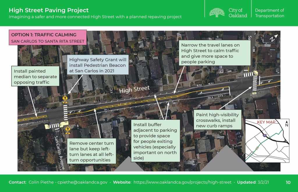
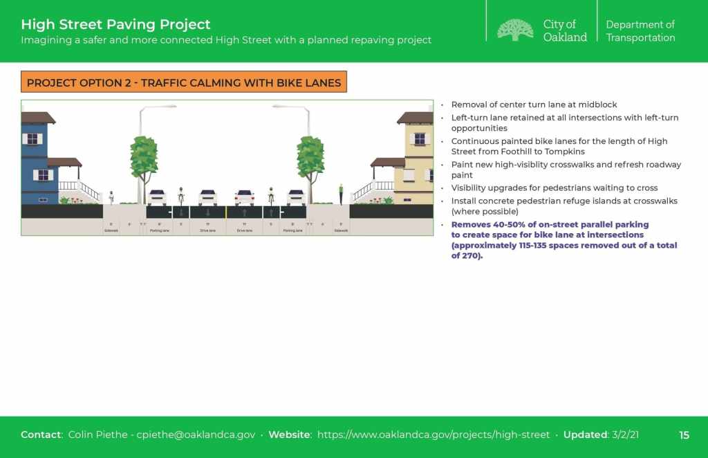
- Road diet proposed to remove center turn lane, keeping left turn pockets at intersections
- Staff sent out 7000 postcards to neighbors to ask for feedback via online survey. There are already 600 responses after just a few days.
- Pedestrian crossing safety signal upgrades are already funded and to be installed.
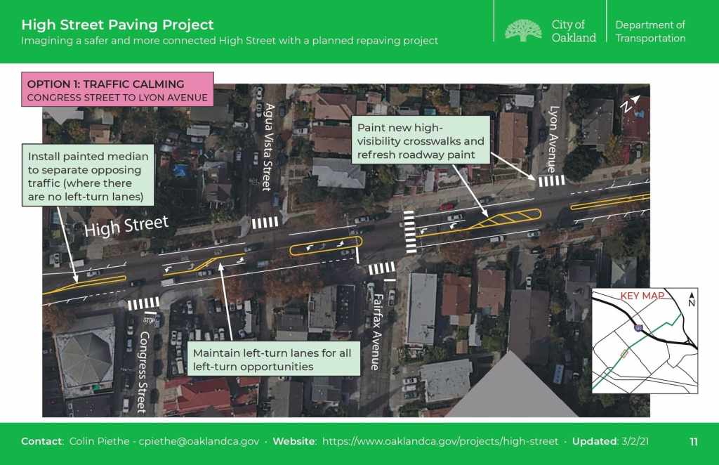
- Option 1 – Traffic calming
- Replaces center turn lane with narrow striped median – One travel lane each way – Wider parking aisles
- Does not provide bike lanes recommended in the 2019 bike plan update
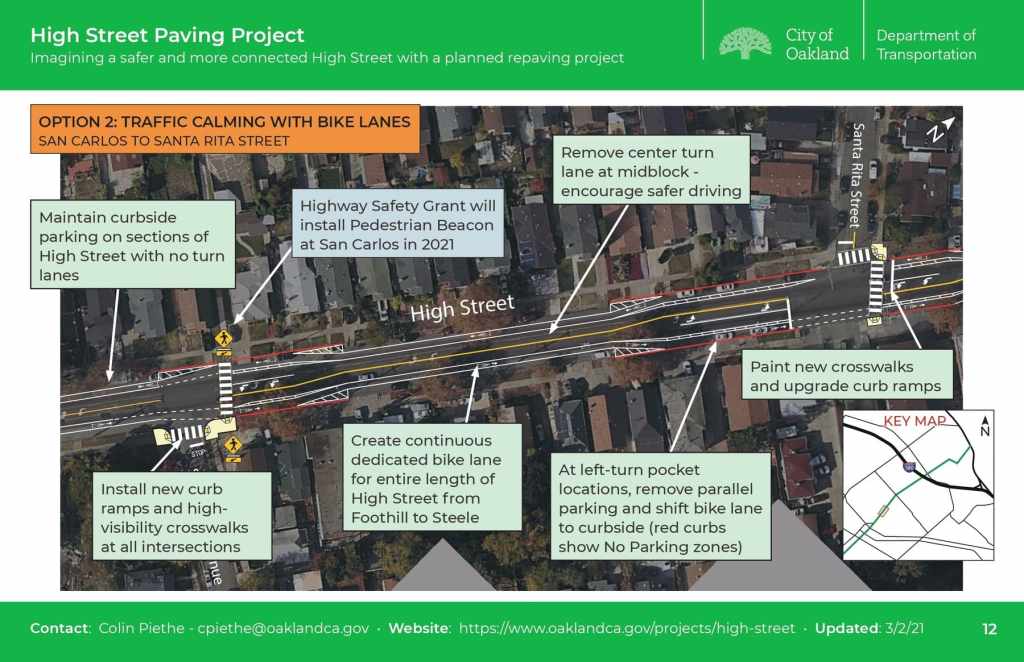
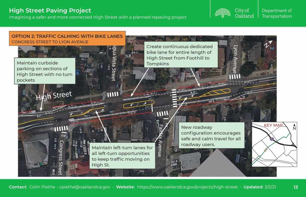
- Option 2 – Traffic calming with bike lanes
- Painted bike lanes, partially curbside in place of existing curbside parking
- Currently neighbor survey responses are split about 50/50 between the two options.
Discussion
- Center turn lane removal is a great idea—improves safety and discourages people for speeding down the middle of the road.
- Commenter currently bikes on 35th Ave instead of High St. 38th Ave is steeper.
- If High St doesn’t get a bikeway, there won’t be any good alternatives.
- Bike network in this area is very sparse, if no option provided on High St, then it leaves a big hole in the overall connectivity.
- Curbside bikeway sections need to be protected to prevent car parking.
- Staff are looking into options for this.
- If no bikeway is installed on High Street, then upgrades on parallel routes need to be prioritized—38th Ave, 50th Ave/Monticello, 55th Ave.
- Curbside bikeway sections need to be protected to prevent car parking.
- Is the paving happening on the lower part of High Street between E 12th and Jensen also getting any changes? There are no parallel alternatives for bike riders on this section, though it connects to Tidewater and the Bay Trail.
- Staff haven’t had capacity yet to coordinate on this section, though they could look into it.
- Some hardened medians or pedestrian safety islands could be useful as well, such as at the Courtland intersection.
- Committee member posted project info to Nextdoor. There is overwhelming support for changes in the hundreds of comments, even if not entirely for the bike lane. Staff have also been going to neighborhood crime prevention committees (NCPCs) to communicate about the project.
